Nuclear Waste Storage & Transport Resources
Protect the Basin Video Resources
Map and Graphic Resources
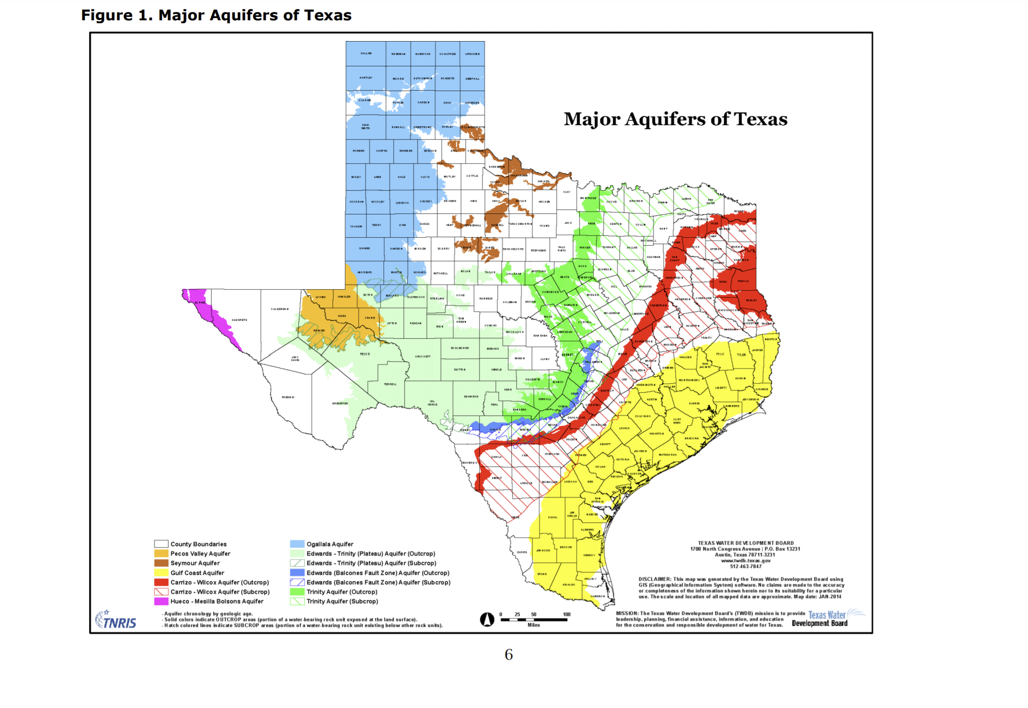
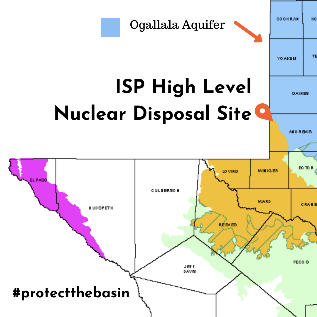
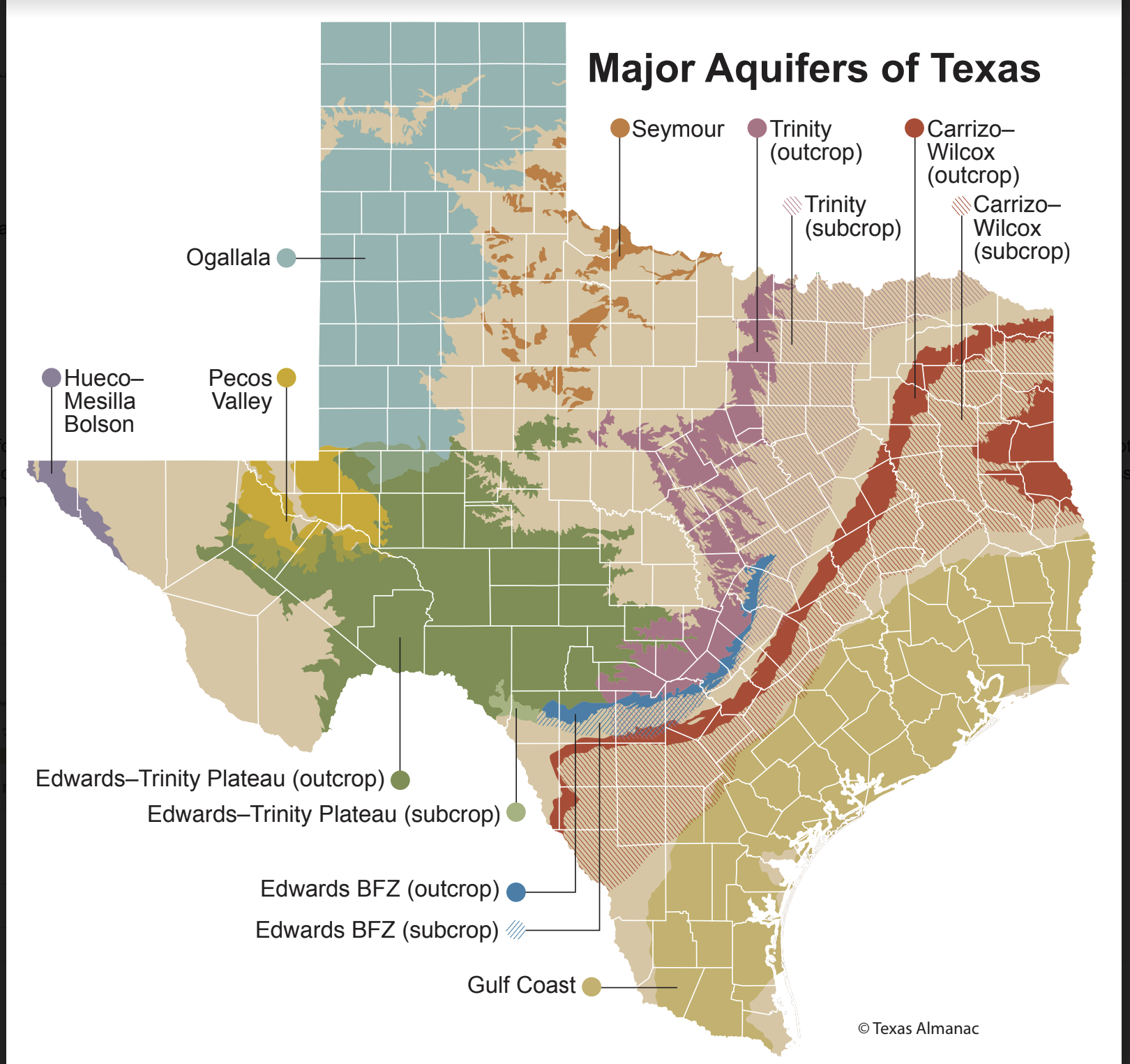
Notice that the Interim Storage Partners’ site, in Andrews County, sits atop the Pecos Valley Aquifer.
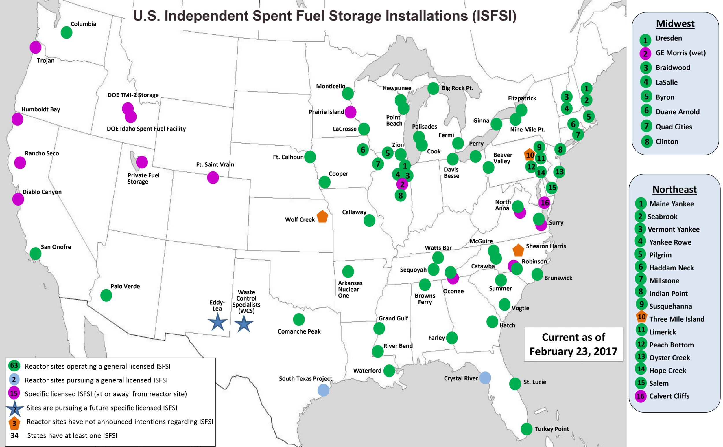
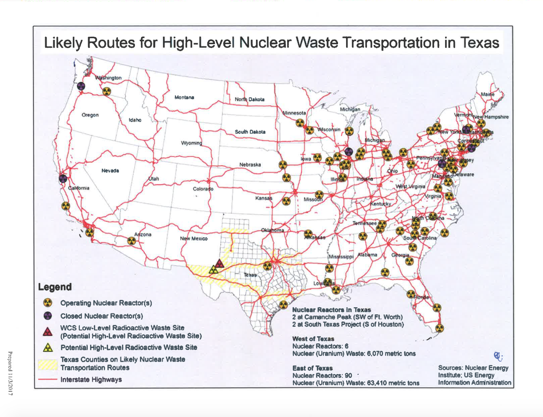
This map showcases the distance between nuclear reactor sites in the United States and the two proposed interim storage sites in West Texas and SE New Mexico.
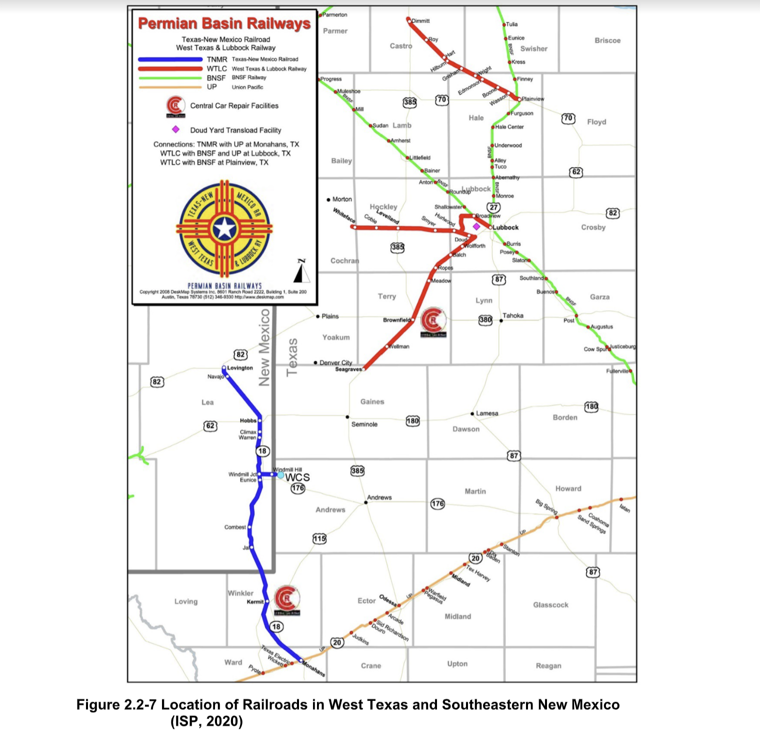
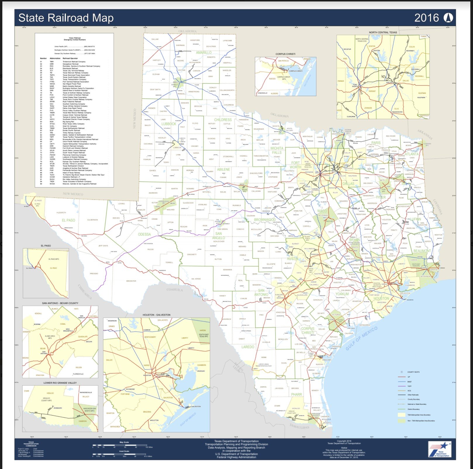
The major railways that cut through West Texas and Southeastern New Mexico counties and towns.
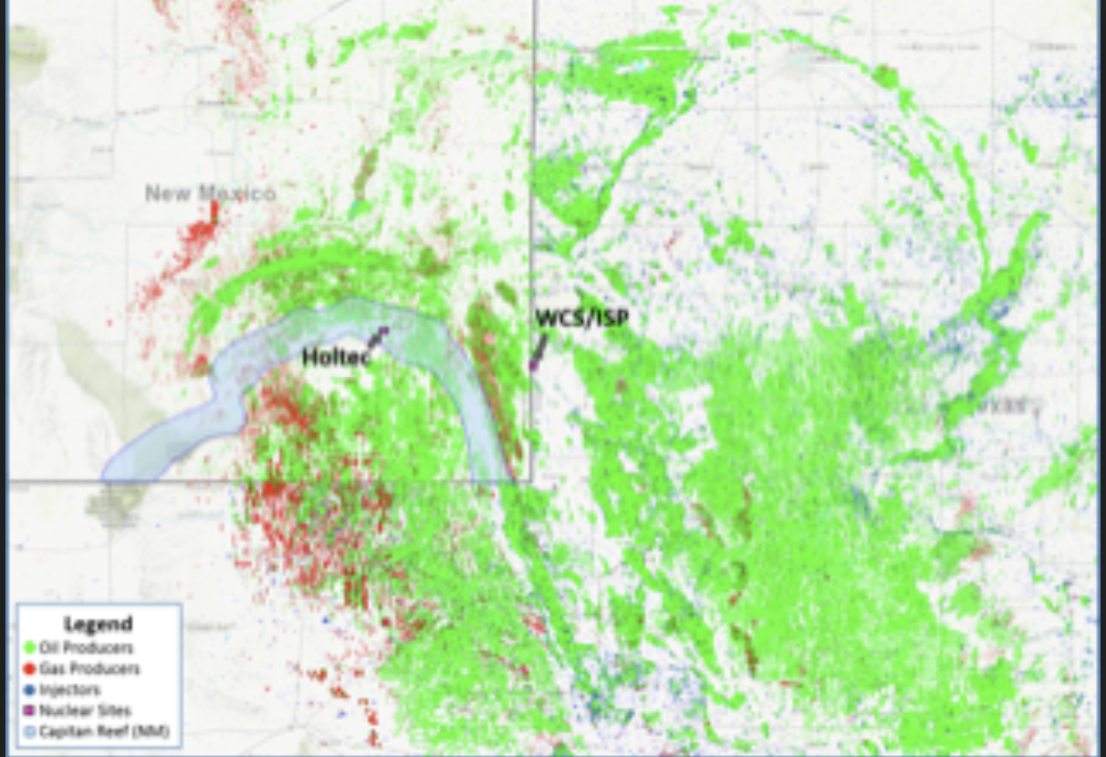
This map shows the density of oil and natural gas wells, both active and inactive, that are in the vicinity of ISP and Holtec sites.
A map of the major aquifers in Texas. Interim Storage Partner’s site is on top of the Pecos Valley Aquifer.
A map of the rail routes that high level nuclear waste will travel when it is transported to the Permian Basin.
Routes that lead to Andrews County are fair game for high-level nuclear waste transportation. These routes include highly urban areas as well as rural towns.


